 Punnayoorkkulam is a village situated in the north-western outskirts of Thrissur district. It covers an area of 18.71 sq. km. with the Arabian Sea forming its western border. To its north is Malappuram district; to its south, Punnayur and Vadakkekkad panchayats; and to its east is Kattakambal panchayat. The village consists of 19 wards. Its population stands at 29,795.
In ancient times, Punnayoorkkulam was part of the Vanneri region which was the headquarters of the Perumpadappu swarooopam [Kingdom of Cochin], one of the princely states in Kerala. Following an attack by the Zamorin, the kings of Cochin shifted their capital, first to Thiruvanchikkulam and later, to Cochin. That was how Perumpadappu swaroopam came to be known as the Kingdom of Cochin. The subsequent history of Vanneri is not clearly known. Punnayoorkkulam was once part of the Malabar region. The route taken by Tipu Sultan through this panchayat, during his invasion, is known as Tipu Sultan Road even today. Until motorable roads were constructed in the 1940s, the people of this panchayat relied mainly on boat rides through waterways to reach Chavakkad and Kattakambal. It was electrified in the 1960s.
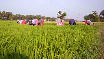
Punnayoorkkulam has a total number of 19 wards. The Uppungal Paddy fields, gaining fame as a ‘bird sanctuary’ which plays host to a variety of birds, are spread over Mavinchuvadu, Punnayoorkkulam, Chemmannur North and Parur wards. The four beaches of Punnayoorkkulam are located in Thangalppadi, Pappali, Andathodu and Periyambalam wards. The ancient Conolly Canal runs through Nakkola, Edakkara, Pappali and Kumaranpadi wards. Thus, nearly every ward in Punnayoorkkulam has some feature that is noteworthy. Given below are the names of the 19 wards of Punnayoorkkulam.
- Thangalppadi
- Nakkola
- Cherai
- Thrippatt
- Mavinchuvadu
- Punnayoorkkulam
- Chemannur North
- Chemannur South
- Parur
- Attuppuram
- Althara
- Punnukkavu
- Kadikkadu
- Poozhikkala
- Edakkara
- Pappali
- Kumaranpadi
- Andathode
- Periyambalam


